Tuesday, February 14, 2006

Texas Hazard Mitigation Package

Happy Valentine's Day!! Don't forget that special someone in your life whether it be a wife, girlfriend, Mom, or sister. I have finally started to uncover from the mountain of emails that were awaiting when I returned yesterday. It just doesn't pay to leave town anymore! Finally, I want to mention that ESRI has really made some improvements on the ArcWeb Explorer beta site. Most of the problems I found when I reviewed it a couple of weeks ago have been fixed. Good job!!

The Texas Geographic Society (TXGS), a not-for-profit corporation located in Austin, Texas, received a FEMA Hazard Mitigation Planning Grant (HMPG) in 2003 as a sub-grantee to the Texas Division of Emergency Management. The purpose of this grant is to develop an Internet-based viewing and distribution tool for digital geographic datasets that can be used by state and local hazard mitigation planners and emergency managers in identifying natural hazards, risk areas and vulnerabilities in Texas. The project, Texas Hazard Mitigation Package (THMP), is a free online resource. Though additional links and supporting information is provided to assist hazard mitigation and emergency management planning, it is essentially these four functions that this site is intended to serve:
1. Identify historical hazard occurences by the event location or summarized by county,
2. Identify hazard risk areas and other detailed geographic data relative to hazards
3. Identify vulnerable population and property value areas to particular hazards, and
4. Download any data to perform detailed quantification of impact on other mapping/GIS systems
Check it out at http://www.thmp.info/.

Monday, February 13, 2006

Zillow

I survived the SCAUG conference.....barely! It was a great event!! Excellent knowledge sharing, good friends, superb entertainment, etc. I can't wait until next year. I little birdy told me it might be in New Orleans. Wooh hoo!!

Zillow is an online real estate service dedicated to helping you get an edge in real estate by providing you with valuable tools and information. "Zillow" evolved from the desire to make zillions of data points for homes accessible to everyone. But a home is about more than data - it is where you lay your head to rest at night, like a pillow. Thus, "Zillow" was born. Zillow.com calculates a valuation (the Zestimate™) that anyone can see — for free — for most homes in the U.S., including yours. Or the one you want to be yours. Or the one you are curious about. The maps use GlobeXplorer and Navteq data. Check it out at www.zillow.com.

Friday, February 10, 2006

16th Annual South Central Arc User Group Conference - Day 5

The last day...we started off with ESRI technical sessions. They inlcuded: What's New in ArcGIS 9.2 Desktop, Introducing ArcGIS Image Server, Taking GIS to the Web, and Tips and Tricks in ArcGIS. Afterwards, we had our closing lunch and awards ceremony. We announced the winners of the map gallery (our GIS Specialist took home first place in two categories for one map....AWESOME!), application contest, fastest map in the west, guess the image, pub crawl, thumbs up award (good job Heather!), and the founders award. We also recognized Elizabeth our conference coordinator for an outstanding job. What a success!!! It's odd how you feel a little depressed or sadened after the conference is over. You work hard all year long for it and when it is over you feel a loss. I know it is odd, but I feel it every year.

Thursday, February 09, 2006

16th Annual South Central Arc User Group Conference - Day 4


Thursday was another long one. The day consisted of user talks, panel discussions and Tours. The panel discussions consisted of ArcIMS, Managing GIS, Emergency Management and GISP which I participated in. We had a tour of City of Fort Worth GIS and a Geocaching Challenge (www.geocaching.com). In the evening we had a great BBQ dinner, a performance of trick roping and bull whipping, and a casino to win prizes. The casino consisted of craps, roulette, blackjack and Texas hold'em. After the casino we moved on to the poker pub crawl. The object was to visit 5 t0 7 pubs and receive a playing card at each. The highest hand wins. What a night!!!!

Wednesday, February 08, 2006

16th Annual South Central Arc User Group Conference - Day 3


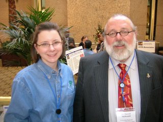
The day started early.....6 a.m.!! That's rough after a night of networking. At 8:30 we had breakfast, announcements of the new officers, a presentation from our K-12 student competition winners and our keynote speaker. You will be able to view the new officers at www.scaug.org soon. Our K-12 student competition winners were from the School of Excellence in San Antonio and they did an excellent project with the San Antonio Water System. Our keynote, Dr. Darrell McDonald, was from my alma mater, Stephen F. Austin State University, and did an excellent talk on regional geospatial service centers. It was good even though the presentation died half way through (technology!!). After breakfast it was on to the vendor hall. We had over 30 vendors this year. Wow! After lunch the day consisted of user presentations. In the evening we had a social which included many fun activities such as: voting on the map gallery, guess the image contest, application contest and the fastest map in the west. What a great day!!

Tuesday, February 07, 2006

16th Annual South Central Arc User Group Conference - Day 2


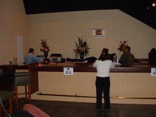
Day two of the conference continues with the second day of training. This years training classes were great. They included Introduction to Multi-user Geodatabases, Geoprocessing with Scripts, GIS Analysis, Advanced ArcSDE Administration and Model Builder. Registration of people arriving early for Wednesday has also began. We also stuffed hundreds of bags in preparation for the big day.

Monday, February 06, 2006

16th Annual South Central Arc User Group Conference - Day 1


The first day of the conference has been great so far. All training classes are booked up and we are ready for the large numbers of people on Wednesday. All is well so far!! It's not too late to attend. More info can be found at www.scaug.com.

Sunday, February 05, 2006

16th Annual South Central Arc User Group Conference

Last week was a killer! With normal work being busier than ever and preparing for the SCAUG conference, I'm glad it's over. We are submitting a map and it is looking really good if I don't say so myself. It is a fire station location analysis using drive times that were created with Network Analyst.

I'm going to dedicate the entire week of posts to the conference. I'll try to give pictures from each day. It should be a good time and it's not too late to attend. Learn more at www.scaug.org.

Thursday, February 02, 2006

ArcWeb Explorer (Beta Release)

Good day! I saw an interesting post on the GISUser blog about a flying car in Australia on Google Earth. You can check out the article here http://www.smh.com.au/articles/2006/01/30/1138469638185.html. At first I thought it was a billboard, but then I read that someone has visited the site and nothing is there. Weird!!

ArcWeb Explorer is ESRI's new Web-based map viewing application based on Macromedia Flash 8. The ArcWeb Explorer uses vector mapping technology to render maps quickly in the browser instead of having the server render them. The result is improved speed and performance, greater control over the map appearance, and desktop-like functionality over the Internet. In addition, ArcWeb Explorer provides access to ArcWeb Services so you can easily find locations by street address, telephone number (land line), and IP address. This is a pretty cool function, but it is not accurate. I searched for three phone numbers and they all took me to the correct City, but not the correct address. The find this computer function doesn't work either! You can also create a route and directions between locations and map locations from Excel spreadsheets. Although the directions don't work either. I did a route from my office to my home and it didn't even place the points in the right cities. I know it is beta, but come on!! Check it out at http://www2.arcwebservices.com/v2006/solutions/awx.jsp.

Wednesday, February 01, 2006

gVisit

Happy hump day! The SCAUG conference is approaching quickly and final preparations are under way. It should be a good one!! You can find out more at www.scaug.org. Let me know if you have questions.

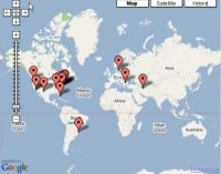
gVisit records unique visitors and cities to your website on a Google Map. You can register your website for free and they don't collect any personal information - not even an email address. You will be given your own URL that lets you track your visitors and all you have to do is copy and paste a single line of JavaScript to your website. Check out my gVisit map on the bottom right of my blog. You can get your own gVisit map at www.gvisit.com.

Planet Geospatial

ESRI.com - News

GISUser.com - The complete GIS, LBS, and Geospatial Technology Resource

A VerySpatial Podcast