Wednesday, October 26, 2005

GeoPlace


Only 21 Days to GIS Day! Just a reminder. We are working hard on preparations to educate our City employees on the benefits of GIS. It should be a fun event.

GeoPlace.com is the authoritative resource for spatial information as well as the home of GeoWorld. GeoWorld is a must read if you don't already receive it and it's FREE. GeoPlace.com provides a wide range of resources from events, hot topics, stores, etc. Check out www.geoplace.com and GeoWorld!

Tuesday, October 25, 2005

Geospatial Information & Technology Association


Hello. Well, it's going to be another busy day. I have two interviews for my GIS Technician position. I can use the help!!

The Geospatial Information & Technology Association (GITA) is a nonprofit educational association serving the global geospatial community. Their website has been created with the intent of providing you a variety of information and useful references for your professional and technical needs. It provides you with important member contacts, industry news, and association-related ongoing programs. You can learn more at www.gita.org.

Monday, October 24, 2005

Association of American Geographers


Hi! I hope everyone had a nice weekend. The planning for the 2005 SCAUG Conference is coming along nicely. We all received the giveaways that we will be handing out and they are very nice. I also can't say much about it, but "CASINO NIGHT". I also enjoyed the Renaissance Festival as usual (I ate too much!).

The Association of American Geographers (AAG) is a scientific and educational society founded in 1904. For 100 years the AAG has contributed to the advancement of geography. Its 7,500+ members from 62 countries share interests in the theory, methods, and practice of geography, which they cultivate through the AAG's Annual Meeting, two scholarly journals (Annals of the Association of American Geographers and The Professional Geographer), and the monthly AAG Newsletter. The AAG promotes discussion among its members and with scholars in related fields, in part through the activities of its affinity groups and 53 specialty groups. For more information please visit www.aag.org.

Thursday, October 20, 2005

United States Census Bureau

I am off to San Antonio after work today for a SCAUG meeting at the ESRI Regional Office. It will be nice to see the SCAUG crew again. On Saturday, the girlfriend and I are going to the Texas Renaissance Festival. If you have never been, it is an incredible experience. I feel like I am walking back into the 16th Century as I enter the World's largest Renaissance theme park (www.texrenfest.com).

If you haven't used Census data your Geography Professor needs to be fired!! The United States Census Bureau provides a wealth of data. If you are mapping something people related, you should look into this website. You can find MUCH more information at www.census.gov. Have a good weekend!!

Wednesday, October 19, 2005

Environmental Protection Agency


I'm going to post in the morning before I get too busy to post at all. We are in the middle of database design here at the City and GIS Day is approaching rapidly. I'll be glad when December gets here so it slows down a bit.

The Environmental Protection Agency is a great source for GIS data. The GIS Data Download component of C-MAP allows you to download GIS datasets. The various emissions and effects datasets can be visually integrated and analyzed in map format according to your area of interest. Many of the GIS datasets can be expanded through the use of related tables, downloadable in dBase IV format. Data summaries and metadata compliant with Federal Geographic Data Committee standards are also available with each dataset. For more information please go to http://www.epa.gov/airmarkets/cmap/data/index.html. Enjoy!

Tuesday, October 18, 2005

Geography Network


What a long day! I am busier than ever at work right now, so if you don't see my post first thing in the morning don't worry. I will do my best to meet my Monday thru Friday goal whether it's 7:30 in the morning or 7:30 at night!

The Geography Network provides access to geographic content from hundreds of organizations around the world. The content ranges from dynamic map services that can be viewed online to static geographic data sets that can be downloaded for use with mapping software. You can find data three ways: the Geography Network Explorer, the Geography Network site, and the National Spatial Data Infrastructure (NSDI) Clearinghouse.
The Explorer lets you search or browse for content. You can then view details describing the content and preview it through the Explorer. It is amazing how much data is out there, Check it out at www.geographynetwork.com.

Monday, October 17, 2005

American Congress on Surveying and Mapping

Good Monday Morning! I had quite the relaxing weekend and I am now ready for the week. I have so much to do and work and I am leaving for San Antonio again Thursday night. I need to quit traveling so much!

Originally named the National Congress on Surveying and Mapping when it was founded in June 1941, the society sought to better coordinate the nation's surveying and mapping activities. Later the name was changed to the American Congress on Surveying and Mapping (ACSM) to encompass members from Canada and South America. Today, although the majority continue to come from the United States, the members of ACSM’s Member Organizations include more than 7,000 surveyors, cartographers, geodesists, and other spatial data information professionals working in both public and private sectors throughout the world. The ACSM consists of member organizations such as American Association of Geodetic Surveyors (AAGS), Cartography and Geographic Information Society (CaGIS), Geographic and Land Information Society (GLIS), and National Society of Professional Surveyors (NSPS). The non-governing ACSM Congress is comprised of two delegates and one alternate representing each of the Member Organization. The Congress also includes non-voting delegates representing Associate Organizations. The Congress administers the activities that have been agreed upon by the Member Organizations as joint efforts. To learn more go to www.acsm.net/.

Friday, October 14, 2005

Google Earth

It's Friday!!!! I just can't wait to get home tonight so that I can drink beer, play video games and work on the SCAUG newsletter. You know you are a nerd when that is your excitement for the weekend.

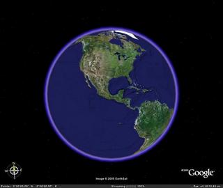
Today I am talking about one of the coolest things to hit the GIS World since the Geodatabase. Google Earth!!! I am addicted!!! What a fun, fast, easy to use tool that is free. Yes, you heard me correctly, FREE! Well, most of it is free. You can upgrade to better versions for a fee, but most of the coolest stuff is free. You can zoom from your hometown to the desserts of Africa to the Grand Canyon in a matter of seconds. It streams the data across the internet, but renders the images in a way that doesn't effect performance. Now that you are getting excited, did I mention it has 3D buildings in most major cities? You can tilt the globe so that you are standing on a street in New York City looking up at the skyscrapers. You can also use it as a what I am calling a "geo-search engine". If you are in Chicago and you want to find a pizza joint, just type "Pizza" in the local search field and they are placed on the map along with links to their websites. Wow!!! To learn more please visit, www.earth.google.com. Did I mention it was free?

Thursday, October 13, 2005

ESRI

Hi! The end of the week is approaching quickly and the weather here in East Texas is beautiful. I must get outside this weekend!!!

Today I am going to talk about ESRI. ESRI is the number one GIS software company in the World. They began the company back in 1969. Their success in GIS is built on the belief that geography matters. It fundamentally influences and connects our many cultures, societies, and ways of life. On their website they explain, "Our technology helps fight forest fires, determine new national boundaries during peace negotiations, find promising sites for fast-growing companies, rebuild cities around the world, support optimal land use planning, route emergency vehicles, monitor rain forest depletion, contain oil spills, and perform countless other vital tasks every day". ESRI has more than 4,400 skilled employees worldwide who work with hundreds of business partners and tens of thousands of users. If you are not familiar with ESRI please visit their website at www.esri.com .

Wednesday, October 12, 2005

Urban and Regional Information Systems Association


Howdy! I am going to chat today about the Urban and Regional Information Systems Association (URISA). URISA is considered to be the premier organization for the use and integration of spatial information technology to improve the quality of life in our urban and regional environments. I recently joined URISA because I was impressed with some of the things they are doing for the GIS Profession. They started GIS Corps, a volunteer emergency GIS group to help with the many natural and unnatural disasters we keep having in the World. I will talk more about GIS Corps in the near future. URISA also helped start the GIS Certification Institute which I talked about in a previous post. You can find more information about URISA at www.urisa.org.

Tuesday, October 11, 2005

South Central Arc User Group

I'm back! Monday was hectic since it was my first day back from San Antonio. I'll do my best to post everyday, but things happen.

As I get back into the swing of things, I thought it would be a good time to talk about another organization that I am involved with. The South Central Arc User Group (SCAUG) is an organization dedicated to the benefit of users of ESRI's Geographic Information software in the states of Texas, Oklahoma, Louisiana, Mississippi, Puerto Rico and the Cayman Islands. Unfortunately, we don't have any members from Puerto Rico or the Cayman Islands, but I am working on it. SCAUG is a great group that is very active and has alot of fun. We have a yearly conference that attracts about 200 users. It includes users presentations, training, vendors, etc. This years' conference will be held in Fort Worth in February. I will give a recap on the GeoBlog after the coference. Please take a look at SCAUG's excellent website (www.scaug.org) which is one the duties I am responsible for.

Friday, October 07, 2005

East Texas GIS and GPS Users Group


Happy Friday! Well, I finish my training class today. I am ready to be home for a while. You don't realize how much you miss things like taking out the trash until you can't do it. Ha!

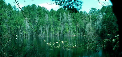
Anyway, today I am going to talk about the East Texas GIS and GPS Users Group (ETUG). ETUG is a small users group for East Texas and Western Louisiana. We get together quarterly, have lunch and discuss projects that we are working on. I will be president after the New Year and I hope to breathe new life into the organization. Historically, it has been based on more of a social level and I want to bring some technical and professional aspects to the group. We will see how well it is received. I'll keep you posted. While searching for a good map of East Texas I came across this wonderful picture of the old Aldridge Sawmill Site mill pond. I have been to this location and it is a good example of how beautiful East Texas is. You can find out more information at Texas Beyond History. It gives a little history of the East Texas timber industry as well. For more information on ETUG please visit our Yahoo! Groups page at ETUG-L. Here you can sign up to be email listserv to keep updated on events.

Thursday, October 06, 2005

GIS Proffesional Certification

I just finished my presentation of a chapter of Introduction to ArcGIS I so that I can be authorized to teach it. I'm glad that is over! I can tell that I have a lot of preparation to do. The ESRI Authorized Training Program is an interesting concept. Look into it if you aren't familiar.

Today I am going to talk about Professional GIS Certification or becoming a GISP. I became a GISP about six months ago and I am glad I did. The GIS Certification Institute (GISCI) is an "organization that provides the geographic information systems community with a complete certification program. GISCI offers participants from the first early years on the job until retirement a positive method of developing value for professionals and employers in the GIS profession". The certification process is straightforward and is based on three primary criteria: education, experience and contributions to the industry. My favorite part of the certification process is the requirement for contributions to the industry. This makes individuals get involved and keeps them involved because re-certification is required every five years. The most common question I get about the GISP program is if a test is required. The answer is no because GIS is such a broad field and a standardized test is near impossible. For more information please visit www.gisci.org.

Wednesday, October 05, 2005

GIS Day


Good Morning! It is amazing how much work you can get done while you are away from the office. I need to leave town more often!

Anyway, today I am highlighting GIS Day. This year GIS Day is on November 16th (42 days remaining according to gisday.com). For those that don't know, "GIS Day is a grassroots event that formalizes the practice of geographic information systems (GIS) users and vendors of opening their doors to schools, businesses, and the general public to showcase real-world applications of this important technology." At my City we will be hosting an open house for all City employees. We felt this would be best since it is the first GIS Day for the new GIS Division. If you have never hosted a GIS Day it is alot of work, but very rewarding at the same time. I encourage you to consider it. Find out more along with plenty of planning materials at www.gisday.com.

Tuesday, October 04, 2005

Welcome & GIS.com

Well......here goes....this is my first post on GIS GeoBlog! Welcome! As it says at the top of the page "This is the place for anything and everything GIS related for everyone from advanced users to newcommers. It will include articles, websites, software, hardware, applications, events, user groups, etc." This idea came to me today while attending a training class at ESRI San Antonio. I am sure many other sites similar to this already exists. Although, I hope that I can continue to promote and inform everyone about the power of GIS in my own little place on the web. Please feel free to email me with suggestions or questions about the blog.

I thought I would start off with the basics. GIS.com. GIS.com is a website maintained by ESRI. ESRI has the market in GIS throughout the World (I will talk more about ESRI in the near future). GIS.com educates by explaining what GIS is, what you can do with it, how to implement it, careers, etc. etc. etc. Please visit www.gis.com if you never have......who knows you might learn something new.

Planet Geospatial

ESRI.com - News

GISUser.com - The complete GIS, LBS, and Geospatial Technology Resource

A VerySpatial Podcast