Thursday, December 29, 2005

Heavens Above

Happy Friday! Oops, it's not Friday for most of you. Sorry! I'll be enjoying another four day weekend tomorrow. I hope all of you enjoy your day at work. Anyway, we have a GIS User Group meeting here at the City today. If you do not have a similar group at your business I suggest you consider it. It is a great source for open communication.

If you're interested in satellites or astronomy, you should check out Heavens Above. Their aim is to provide you with all the information you need to observe satellites such as the International Space Station and the Space Shuttle, spectacular events such as the dazzlingly bright flares from Iridium satellites as well as a wealth of other spaceflight and astronomical information. They not only provide the times of visibility, but also detailed star charts showing the satellite's track through the heavens. All of their pages, including the graphics, are generated in real-time and customized for your location and time zone. I know this one is not directly related to GIS, but if you use GPS as a data collection tool you will probably be interested. Check it out at www.heavens-above.com.

Wednesday, December 28, 2005

The Nature Conservancy

Hola! I have decided to take Friday off so that I could have one more four day weekend. I need more time off to mentally prepare myself for another year. I just hope that the coming year will be as successful as this year has been!!

The Nature Conservancy has been using GIS for more than a decade. Their usage has grown exponentially as geospatial technologies and data have become more accessible and more capable of meeting their diverse needs. GIS is currently used at all levels of the organization from executives to interns, and across the majority of their functional departments and widely distributed operating units. GIS has become a critical tool for internal planning, analysis and information management. It is also used extensively to produce maps, reports and statistics for external communications and fundraising. GIS assists conservation practitioners in every phase of TNC's Conservation Process. Primary GIS functions of map production, spatial analysis, and data management are woven throughout the four stages of the Conservation Process: Ecoregional Planning > Site Conservation Planning > Conservation Action > Measuring Success. You can also find maps, data and much more information on how the nature conservancy uses GIS at http://gis.tnc.org/.

Tuesday, December 27, 2005

DataPlace

Good Morning! I hope everyone had a nice Holiday weekend. I did well with the loot I received. I got some new globes, a new atlas, a book on Civil War maps and a really cool picture of Richard Nixon bowling (only true Big Lebowski fans will understand). With the New Year quickly approaching I will be contemplating what my New Year's resolutions will be and how many points the Longhorns are going to beat USC by (I'm thinking at least 14). Have a great week!!

DataPlace aims to be your one-stop source for housing and demographic data about your community, your region, and the nation. The site not only assembles a variety of data sets from multiple sources, but it also provides tools and guides to assist you in analyzing, interpreting, and applying the data so you can make more informed decisions. DataPlace provides easy access to data at geographic scales ranging from the neighborhood to the nation. The site currently contains data from the 1990 and 2000 Censuses (demographic, economic, housing, and social characteristics), Home Mortgage Disclosure Act (home mortgage applications and loans), Section 8 Expiring Use database (neighborhood- and property-level data on federally assisted housing at risk of loss), and Consolidated Plan special tabulations (data on housing needs by household income level). DataPlace's data library will expand in the coming months to include information on topics such as business establishments from the Census Bureau's ZIP Business Patterns database and Low-Income Housing Tax Credit developments from the U.S. Department of Housing and Urban Development. DataPlace also provides a powerful yet simple mapping tool that allows you to produce colorful thematic maps with just a few clicks of the mouse. You can customize a map's appearance by selecting different color schemes or interval ranges for your themes and save the results to a PDF file. Future enhancements to the mapping tool will allow you to define your own market area by selecting groups of census tracts, counties, or states and upload your own data for mapping in conjunction with data already provided on DataPlace. Check it out at www.dataplace.org.

Thursday, December 22, 2005

NORAD Tracks Santa

Good Morning! This will be my last post until next Tuesday. My beautiful Polynesian Princess and I leave for Austin in the morning and then off to Dallas on Christmas morning. We will cover many miles, but it is all well worth to spend the Holidays with our families. Please have a wonderful and safe Holiday and remember it is better to give than to receive.

The GIS User Blog pointed out a great site the other day. NORAD, the bi-national U.S.-Canadian military organization responsible for the aerospace defense of the United States and Canada, has been tracking Santa for 50 years. The tradition began after a Colorado Springs-based Sears Roebuck & Co. store advertisement for children to call Santa on a special "hotline" included an inadvertently misprinted telephone number. Instead of Santa, the phone number put kids through to the CONAD Commander-in-Chief's operations "hotline." The Director of Operations, Colonel Harry Shoup, received the first "Santa" call on Christmas Eve 1955. Realizing what had happened, Colonel Shoup had his staff check radar data to see if there was any indication of Santa making his way south from the North Pole. Indeed there were signs of Santa and children who called were given an update on Santa's position. Thus, the tradition was born. So, how do they do it? It all starts with the NORAD radar system called the North Warning System. This powerful radar system has 47 installations strung across Canada's North and Alaska. NORAD makes a point of checking the radar closely for indications of Santa Claus leaving the North Pole on Christmas Eve. This Christmas Eve watch NORAD track Santa at http://www.noradsanta.org/en/. Have a Merry Christmas!!!

Wednesday, December 21, 2005

Google Transit

I'm recovering nicely from our Holiday party at my supervisors' house. It was a great time!! I even came away with an electric flyswatter (you don't see one of those everyday)!

Google is at it again!!! Google Transit could change the way we travel and hopefully increase our need for public transportation. Do you live in or near a city? Want to go someplace—to the airport, to dinner, to work every day—and not worry about the hassles and expense of driving and parking? Google Transit Trip Planner enables you to enter the specifics of your trip—where you're starting, where you're ending up, what time of day you'd like to leave and/or arrive—then uses all available public transportation schedules and information to plot out the most efficient possible step-by-step itinerary. You can even compare the cost of your trip with the cost of driving the same route! At the moment they are only offering this service for the Portland, Oregon metro area, but they plan to expand to cities throughout the United States and around the world. Check it out at http://www.google.com/transit!

Tuesday, December 20, 2005

Geocaching

Good Day! I have been running late all morning. I hope I am not playing catch-up all day. No worries because we have a FOUR DAY WEEKEND coming up!!

Geocaching (pronounced "geocashing") is an entertaining adventure game for gps users. Participating in a cache hunt is a good way to take advantage of the wonderful features and capability of a gps unit. The basic idea is to have individuals and organizations set up caches all over the world and share the locations of these caches on the internet. GPS users can then use the location coordinates to find the caches. Once found, a cache may provide the visitor with a wide variety of rewards. All the visitor is asked to do is if they get something they should try to leave something for the cache. You can find out much more at www.geocaching.com. Have fun and safe geocaching!!!

Monday, December 19, 2005

ColorBrewer

Somebody has a case of the Mondays!! Luckily it's going to be a short week and I only have three Holiday parties to attend. That's not including the two in Austin and Dallas with the family over the weekend. You have got to love this time of year!!

If you have never used ColorBrewer you need to check it out!! ColorBrewer is an online tool designed to help people select good color schemes for maps and other graphics. It is free and easy to use!! Just follow the "Step1", "Step2" etc. boxes and you'll be creating attractive color schemes appropriate to the nature of your data in seconds. ColorBrewer is a color diagnostic tool - not an online GIS. You cannot load your own data into ColorBrewer. Instead, use their maps to "test drive" a given color scheme to see if it suits your mapping needs. You'll need the free Flash plug-in for you browser if you don't already have it. ColorBrewer was designed by Cindy Brewer, a professor at Penn State University, who just released a book titled "Designing Better Maps: A Guide for GIS Users". Check out ColorBrewer at www.colorbrewer.org.

Friday, December 16, 2005

WildFinder

It's Friday!!! I hope to get my Christmas shopping completed and catch up on some much needed sleep this weekend. Don't forget that this is a great time of year to donate your time or money to local charities. We can all give more!

The World Wildlife Fund (WWF) has created a great site. WildFinder helps you find where wildlife live. You can search by place to see what species live there, search by species to see where they live, or select and print a quick-map of global diversity patterns. WildFinder is a map-driven, searchable database of more than 26,000 species worldwide, with a powerful search tool that allows users to discover where species live or explore wild places to find out what species live there. Containing information on birds, mammals, reptiles, and amphibians, WildFinder is a valuable resource for scientists, students, educators, travelers, birdwatchers and nature enthusiasts alike. Check it out at http://www.worldwildlife.org/wildfinder/.

Thursday, December 15, 2005

A GIS Christmas!!

I am officially an ESRI Authorized Instructor for ArcGIS I! I must admit that the process was more difficult than I first thought. Anyway, if you know anyone that needs training here in Texas let me know.

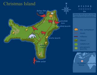
Only 10 shoping days to Christmas!! Trying to find something "special" for that "spatial" person? How about a cool GIS t-shirt that says "Mapster" from www.gisnuts.com? Or possibly a new book from ESRI Press (you can find most of them cheaper on Amazon) or the full length GIS video "World in a Box" at http://store.esri.com. You could always go with a reproduction of a historical map at www.davidrumsey.com or www.mapandglobe.com. Even better would be the latest and greatest GPS from www.megagps.com. If you are light on the funds you could always download some free data from www.gisdatadepot.com. Enjoy the map of Christmas Island, I felt that it was appropriate. Have a Merry Christmas!!!

Wednesday, December 14, 2005

Map24

Good Morning! If you haven't seen this month's GeoWorld you should check it out. Their is a great article titled "Industry Outlook 2006". You can also find it here http://www.geoplace.com/uploads/featurearticle/
0512io.asp
.

Wow!! Map24 is cool! Where to start? First, you can choose from detailed maps of Europe, North America, Brazil and the Middle East. Once you have choosen a map you can search for an address or create detailed driving directions (including multiple stops). Map24.com is a fully interactive map, based on a special internet protocol for vector map streaming, named MapTP, which allows incredible animated zooms from continental view down into city level. Any result list of searches leads is interactive as well and leads to animated map jumps showing each location as you click them. Map24.com shows the full power of client side JAVA! The driving directions can even be modified for speed, path, etc. After you have mapped a route you can even watch it like a movie. Check it out at http://www.us.map24.com/.

Tuesday, December 13, 2005

Map Sex Offenders

Howdy! I counted yesterday and I have six different Holiday related functions to attend here at the City. Wow! I can guarentee that my New Year's resolution is going to include excercise and a diet. I can already feel the pain!!

This is an excellent site for all!! MapSexOffenders.com is part of Orbizon Inc., a privately owned web development and technology company based in Orem, Utah committed to building interactive, easy to use websites that aid users in a variety of ways. The purpose of the site is to inform the general community of sex offenders in their area in a straightforward way. Sex offender registries have been on the internet for many years, but they are hard to find and even more difficult to use. MapSexOffenders.com is simply a map so that the data can be easily viewed. Each sex offender is highlighted on the map and you can zoom in to view the offender, address, and other information. The map also links to the state registry for additional information such as the vehicles offenders drive and their convictions. Parents concerned about their neighborhood or those who are moving can use this free service to make sure they are in a safe neighborhood. MapSexOffenders.com maps all sex offenders in Alabama, Arizona, Arkansas, California, Colorado, Connecticut, DC, Delaware, Florida, Georgia, Hawaii, Idaho, Illinois, Indiana, Kansas, Kentucky, Louisiana, Maryland, Massachusetts, Minnesota, Mississippi, Missouri, Montana, Nebraska, New Hampshire, New Jersey, New Mexico, New York, North Dakota, Ohio, Rhode Island, South Carolina, Tennessee, Texas, Virginia, Washington, West Virginia, and Wyoming. It is their goal to map all 50 states in an interactive, easy to use design. We are going to create a link to their site from our Police website and I will never move into a new place without checking this site first. Check it out at www.mapsexoffenders.com.

Monday, December 12, 2005

Windows Live Local

It's been a Monday! I am trying to catch up from being out Thursday and Friday. It was worth it because this years SCAUG conference is going to be great! We are also going to have a great year with ETUG. I have big plans now that I'm president. I'll tell you more in the near future.

Virtual Earth has a new name, a new look and new features. Virtual Earth is now called Windows Live Local and inlcudes an incredible amount of new images, enhanced features, and new ways to find what you're looking for. Some of the new features include Bird's Eye Images (Pictometry), Driving Directions, Custom Pushpins, New Mouse Features and Scratch Pad Updates. It sounds as if Google Maps has some competition. I also like that they have better aerial photos in areas than Google Maps. Check it out at http://local.live.com/.

Friday, December 09, 2005

GIS Librarian???

Happy Friday! As you can see this post is very early. I am on my to Dallas (McKinney) for a SCAUG meeting. It is going to be a long day, but what are you going to do when you live in the sticks. I am also the new president of ETUG as of yesterday. We also have the big work holiday party this Saturday. It should be fun!! What a busy week. Have a great weekend!!

GIS Librarian?? When I heard this term the other day I wasn't sure what to think. So I did a little research. A GIS Librarian is a library professional with knowledge of GIS data models, concepts, techniques, technologies, and information and library science, and who can apply this knowledge
in collecting, organizing, disseminating, and preserving geographically referenced data, providing general help in GIS reference and in displaying geospatial data. That makes sense to me. Wouldn't it be cool to walk into your public library in the future and ask to speak to the GIS Librarian. You never know?!?!? An example of a GIS Librarian today is at the University of Texas at Arlington. You can find out more at http://library.uta.edu/gis/gis.jsp. The GIS Librarian there, MAPZ, also has a great blog. It is loaded with all sorts of information and great ideas. Check it out at http://mapzlibrarian.blogspot.com/.

Thursday, December 08, 2005

Open Geospatial Consortium

Good Morning! I get to work from home part of the day today since I have a meeting near my house. It was good timing because it is cold and icy in places. What a change from this past weekend when I was wearing t-shirts. Have a good day and stay warm!!

The Open Geospatial Consortium, Inc. (OGC) is a non-profit, international, voluntary consensus standards organization that is leading the development of standards for geospatial and location based services. Through their member-driven consensus programs, OGC works with government, private industry, and academia to create open and extensible software application programming interfaces for geographic information systems (GIS) and other mainstream technologies. Adopted specifications are available for the public's use at no cost. Check them out at www.opengeospatial.org.

Wednesday, December 07, 2005

The Degree Confluence Project

Good morning!! I hope everyone is getting caught up with work as the Holidays approach. I know that at this time of year the workload seems to lighten a little. I'm sure as soon as I say that the work will rain down on me. I sure hope not :()

The Degree Confluence Project is a cool idea that I ran across the other day. It seems it has been going on for some time. The goal of the project is to visit each of the latitude and longitude integer degree intersections in the world, and to take pictures at each location. The pictures and stories are then posted on the website. The project is an organized sampling of the world. There is a confluence within 49 miles (79 km) of you if you're on the surface of Earth. They have discounted confluences in the oceans and some near the poles, but there are still 11,932 to be found. You can help find one and add a picture at www.confluence.org.

Tuesday, December 06, 2005

Where It's At...

Howdy! I have been trying to get ready for my busy week that starts tomorrow. I have my quarterly GIS Executive Committee meeting on Wednesday. The Executive Committee is like a steering committee for GIS here at the City. If you do not have something like this in your organization you might want to think about it. It sure is helpful. On Thursday we have a East Texas GIS/GPS User Group Meeting (ETUG) in Lufkin and on Friday we have a South Central Arc User Group (SCAUG) conference planning meeting in Dallas. I will survive!!

"Where It's At" is a website produced by the Spatial Sciences Institute Young Professionals who are a group within the Spatial Sciences Institute in Australia and New Zealand. The site includes a 'Where It's At... Newsletter' and 'Where It's At... Podcast' with content being sourced from many individuals and groups within the spatial information industry in Australia and New Zealand. Renee Bartolo and Paul Barnett are the current producers and presenters of the Podcast. You can even subscripe to the podcast on Itunes (search for spatial). Check it out at http://whereitsat.org.au.

Monday, December 05, 2005

Cubicworld

I hope that your weekend was as great as mine. We enjoyed the company of friends and saw an excellent Christmas parade and fireworks. It even included a woman riding a Longhorn (only in East Texas). I guess it was fitting since our Texas Longhorns are Big 12 champions and will be competing in January for the national championship. Good job Longhorns!!!

Cubicworld intends to be a forum that links mature or postgraduate students of Remote Sensing and GIS with companies or institutions of the same field to enhance communications within this growing community. Students are represented in an interactive database that shows their qualifications, interests, and contact address. Companies and institutions can present themselves, their work and current internships or job vacancies. Cubicworld is open to everybody who intends to work or offer work in the field of remote sensing and GIS. There is no cost for either side and the entire site is free of commercial advertising. Check it out at www.cubiworld.de.

Friday, December 02, 2005

World Wind

Happy Friday! We have big plans for the weekend, the annual Christmas parade is Saturday in Nacogdoches. Ha! Not much else going on. I look forward to a weekend at home. Have a great one!!

Google Earth has competition?? I didn't know it either until a coworker pointed me towards NASA's World Wind. Actually, I'm not sure you can call it competition since World Wind is open source and completely free. To see how the two differ check out this comparision. World Wind lets you zoom from satellite altitude into any place on Earth. Leveraging Landsat satellite imagery and Shuttle Radar Topography Mission data, World Wind lets you experience Earth terrain in visually rich 3D, just as if you were really there. Virtually visit any place in the world. Look across the Andes, into the Grand Canyon, over the Alps, or along the African Sahara. World Wind leverages Microsoft .NET technology for rapid development and to easily access open standards such as XML, WMS, and other graphics standards. Real-time 3D graphics are driven by DirectX allowing a wide base of compatibility with accelerated video hardware. Primary data sources come from NASA, and TerraServer-USA of Microsoft Research. Oh yeah, it also comes with World Wind Moon so you can explore the Moon too!!! Check it out at http://worldwind.arc.nasa.gov/index.html.

Thursday, December 01, 2005

SlashGISRS

This week is flying by! Before we know it will be Christmas. I will be adding a section to out intranet site here at the City to store .pdf's of maps. That way anyone in the City can print a 8.5X11 of existing maps or see what we have to request a larger version. This will also save other GIS users in the City time in map creation as well. Why reinvent the wheel?

SlashGISRS is an excellent user-driven ad-free non-commercial website for news and discussions about GIS and Remote Sensing. As they state on their site "SlashGISRS is a bridge across space and time to gather the community of the geospatially interested". It is open. Free to read. Free for anyone to share thoughts and ideas. Its content comes from the users. SlashGISRS is slash-based, meaning the content is filtered by members so only the most valuable tidbits reach the casual reader. Check it out at http://slashgisrs.org/.

Wednesday, November 30, 2005

ClustrMaps & BlogMap (Feedmap)

Good Morning! Today I thought I would discuss two new features I added to my blog. ClustrMaps allows you to see at a glance (with a MAP!) where your site's visitors are located, even when the numbers are enormous! Visitors don't need to click on anything, it logs where the IP address of the computer is located. They provide (free) the HTML that gives you a thumbnail map (updated daily), like the one on my blog. When it loads, it increments a counter and shows the locations of all the visitors to your page, cumulatively (even for huge numbers). Since my ClustrMap is new you only see my location. Check them out at www.clustrmaps.com.

Blogmap (by Feedmap) lets you geocode your blog, browse already geocoded blogs and search for blogs. Or as they put it "a place where blogs meet maps and location!". Once geocoded, you can get your own BlogMap location using a simple url that allows you to network with your local bloggers and much more! I also love the fact that the Blogmap is interactive. You can pan and zoom right on the blog. Too Cool! Get your own Blogmap at www.feedmap.net.

Tuesday, November 29, 2005

Planet Geospatial


It's Tuesday!!! Have you ever noticed that there is nothing exciting about Tuesday? Monday is the beginning of the week and Wednesday is the middle. Thursday is close to Friday and a good night to go out for drinks. Friday is of course the beginning of the weekend. Poor Tuesday :(

Planet Geospatial is an aggregation of public weblogs written by GIS Professionals and Hobbyists. This allows you to go to one place to catch up on all the great GIS weblogs. James Fee maintains Planet Geospatial and also has his own blog Spatially Adjusted (www.spatiallyadjusted.com) Check out Planet Geospatial at www.planet.spatiallyadjusted.com.

Monday, November 28, 2005

ePodunk

Good Morning!! I hope everyone had a great Thanksgiving!! Mine was quite relaxing and I slept more than I have in months. I could use more four day weekends. Oh well, back to the grind :)

ePodunk provides in-depth information about more than 25,000 communities around the country, from Manhattan to Los Angeles, Pottstown to Podunk. When they say in-depth they mean it. You can find information from thousands of sources, including government agencies, databases, print reference works and news organizations. Their listings include geocoded information about thousands of parks, museums, historic sites, colleges, schools and other places across America. Their motto is "We believe in the power of place" and they make you believe in it too. Check out your community at www.epodunk.com!

Wednesday, November 23, 2005

Frappr

Happy Thanksgiving Eve! I'll be out of the office till Monday so no posts till then. I'm leaving for the great City of Austin after work to enjoy my Holiday with the family. I'll try not to O.D. on the tryptophan!

Frappr is a cool site that lets you share and create maps on the internet using Google Maps. Or in their words, "Create maps for your group, share your favorite locations, or just explore!". You can also post and share pictures with an option to "map it!" I will be posting various pictures from different travels and events. I also created a map where I am inviting folks to post their location and picture. Please do so at http://www.frappr.com/gisgeoblog. You can also find the link and a picture slideshow at the bottom of the blog. You can find out more at www.frappr.com. Happy Thanksgiving!!!

Tuesday, November 22, 2005

Very Spatial

Good Day! I've been trying to take advantage of my short week by catching up on projects that I have been putting off. I put in almost 13 hours yesterday, but we now have a GIS intranet site here at the City. Also, check out the GeoURL button on the bottom right of the page. GeoURL is a location-to-URL reverse directory. This allows you to find URLs by their proximity to a given location. Find your neighbor's blog, perhaps, or the web page of the restaurants near you. By clicking on the link you can see the sites near my home. Check it out at http://geourl.org/near?p=http://www.gis-geoblog.blogspot.com.

I am "Very" excited about today's post. VerySpatial.com offers a Very Spatial Podcast which is your weekly source for information on Geography and geospatial technologies. Geography touches most things we do everyday, but we rarely even think of it. This podcast seeks to point out how it is filtering into our digital lives and daily lives. The majority of the connections are currently through iTunes. You can also use one of the myraid of great RSS aggregators to connect using our Feedburner link. There is always the low tech version where you make sure you go to the page to download the podcast each week. The VerySpatial blog is intended to be a location for the hosts and participants of A VerySpatial Podcast to link to interesting sites and articles on Geography and related information. In addition to the blog itself the site hosts columns, links, and a few downloads on relevant topics. Check it out at www.veryspatial.com.

Monday, November 21, 2005

United States Department of Agriculture


Good Monday morning! We have a short week this week, yay! I wanted to share something that I enjoy on Mondays. National Public Radio (NPR) has a segment that they do called 'This I Beleive'. 'This I Believe' is based on a 1950s radio program of the same name. This exciting national project invites you to write about the core beliefs that guide your daily life. Find out more and listen at http://www.npr.org/templates/story/story.php?storyId=4538138.

The United States Department of Agriculture Geospatial Data Gateway provides One Stop Shopping for natural resources or environmental data at anytime, from anywhere, to anyone. The Gateway allows you to choose your area of interest, browse and select data from the catalog, customize the format, and have it downloaded or shipped on CD. Check it out at http://datagateway.nrcs.usda.gov/GatewayHome.html.

Friday, November 18, 2005

GIS Day Success Stories

What a week!! Our GIS Day was great! We had over 125 people attend that viewed maps, applications, videos, etc. I can't say that I'm not glad it is over, but it was alot of fun and we are already planning next year's event! To see more success stories or to submit your own go to http://www.gisday.com/success.html. Have a great weekend! I will be eating my first turkey dinner of the season with my girlfriends family. Mmmmmmmmm!

Wednesday, November 16, 2005

Happy GIS Day!!

Happy GIS Day!!!! Thousands of events around the world will most definitely be furthering the goal of increasing awareness and sharing knowledge about geography and geographic information system (GIS) technology in every corner of the globe. Here at the City we are ready to share the knowledge. The maps are hung, the demos are wired and the staff is excited. Let the fun begin! I wish everyone a successful and rewarding GIS Day!!!

Tuesday, November 15, 2005

Geographic Resources Analysis Support System (GRASS)

Good Morning! As you can see it is early, but we must get started early to setup for GIS Day. Cross your fingers for us that all goes well.

Geographic Resources Analysis Support System, commonly referred to as GRASS, it is a Geographic Information System (GIS) used for geospatial data management and analysis, image processing, graphics/maps production, spatial modeling, and visualization. GRASS is currently used in academic and commercial settings around the world, as well as by many governmental agencies including NASA, NOAA, USDA, DLR, CSIRO, the National Park Service, the U.S. Census Bureau, USGS, and many environmental consulting companies. To find out more go to http://grass.itc.it/index.php.

Monday, November 14, 2005

The Geographic Information Center

2 Days to GIS DAY!!! I hope that everyone that is holding an event is almost ready. Preparations can be a little overwhelming, but it is worth it to spread the word about our important technology. Oh yeah, the Shrimpfest was good this weekend, but we also participated in an art walk which was even better. Very relaxing!!

The Geographic Information Center of the National Academies works to build understanding of the relevance and importance of geographic information for addressing societal needs and to point the user to the rich array of ongoing National Academies activities and published reports (readable and searchable for free on the Web) on this topic. Check it out at http://gi.nationalacademies.org/.

Friday, November 11, 2005

The GIS Portal

It's Friday!!! I'm ready to sleep, eat shrimp and work ALL weekend! I don't mind because it means that I am not traveling somewhere. That may sound odd, but I just want to stay home for a while.

The GIS Portal is your source for mapping technology since 1994! The GISPortal (also known as Great GIS Net Sites!) is one of the top web sites for Geographic Information System (GIS) industry information. If you like maps, mapping technology, cool on line 3D mapping software, and the best look at the GIS market anywhere, this is the place! Check it out at www.gisportal.com. Have a great weekend!!

Thursday, November 10, 2005

Directions Magazine

Good day! The weekend is almost here and I am ready for some much needed sleep! I also plan to participate in the Shrimpfest in Nacogdoches. That's right!! Even though we are 150 miles inland we are having a Shrimpfest. Why not???

Directions Magazine publishes weekly newsletters about geographic information systems, global positioning systems, desktop mapping, cartography, computer-aided design, remote sensing, web services, and more. They also offer sections on jobs, tools and data, web map gallery and a map gallery. Check it out at www.directionsmag.com.

Wednesday, November 09, 2005

David Rumsey Historical Map Collection

It's hump day and one week to GIS Day!!!! We are in full preparation mode here. I just hope we don't forget anything major.

The David Rumsey Historical Map Collection has over 12,600 maps online. The collection focuses on rare 18th and 19th century North and South America maps and other cartographic materials. Historic maps of the World, Europe, Asia and Africa are also represented. Collection categories include antique atlas, globe, school geography, maritime chart, state, county, city, pocket, wall, childrens and manuscript maps. The collection can be used to study history, genealogy and family history. You can even purchase reproductions. Check it out at www.davidrumsey.com.

Tuesday, November 08, 2005

U.S. Fish and Wildlife Service

Hola! The week continues with preparations for GIS Day (8 Days!) and the pilot project phase of data cleanup here at the City. If anyone has some interesting GIS news please send it my way for posting. I'll leave you with a joke:
Q: Why did the dot go to college?
A: Because it wanted to become a graduated symbol.

The U.S. Fish and Wildlife Service GIS Home Page provides information on metadata efforts in FWS, free spatial data, and serves as a clearinghouse for other GIS topics such as data standards, training, the A-16 process, global positioning systems, contract information, and technical notes. Data available includes U.S. Fish & Wildlife Office Locations, Interactive Map and Data Server Data Links, National Wetlands Inventory (NWI) Data, Migratory Bird Conservation Data Center: bird population and habitat information, FWS Ecosystem Coverages, Migratory Bird Flyways, etc. etc. To find out more visit http://www.fws.gov/data/.

Monday, November 07, 2005

Geospatial Solutions

I hope everyone had as an enjoyable weekend as I did. I saw some old friends, helped celebrate a beautiful marriage, and enjoyed some wonderful sushi. It doesn't get any better than that. 9 days to GIS Day!!!

Geospatial Solutions is the objective and authoritative forum for emerging intelligence about GIS and related spatial technologies. Industry leaders and peers define issues and share solutions critical to forging a community among professionals from diverse application environments. It is also FREE! You can learn more and subscribe at http://www.geospatial-online.com/geospatialsolutions/.

Friday, November 04, 2005

Google Print

Happy Friday! Well I am off to Arlington tonight to see some old friends and attend a Jewish wedding. The weekend should be great if I can shake this sore throat. Oh well, I will still help the newlyweds celebrate (If you know what I mean). I want to leave you with a little poem that I received in an email yesterday:
Here's to a long life and merry one.
A quick death and a easy one.
A pretty lover and a true one.
A cold beer and another one!
I am featuring the brand new Google Print today. Google Print was released yesterday. As described on their site: "The world's libraries are a tremendous source of knowledge, much of which has never been available online. One of our goals for Google Print is to change that, and today we've taken an exciting step toward meeting it: making available a number of public domain books that were never subject to copyright or whose copyright has expired. We can show every page because these books are in the public domain. (For books not in the public domain we only show small snippets of the work unless the publisher or copyright holder has given us permission to show more.)" I know this is not totally GIS related, but if you do a search for GIS you will see approxiamtely 260 different books. Just think about what kind of resource this is in your everday work. You can see more at www.print.google.com. Have a great weekend!

Thursday, November 03, 2005

GIS Nuts

Good Morning! Thanks to GISuser.com for mentioning this blog on their daily email newsletter. What a surprise! Thanks again Glenn!

Today I'm featuring a fun website, gisnuts.com. These folks have come up with some great t-shirts for the GIS addicts like myself. I think my favorite is "I survived a NAD shift". I'll be placing my order soon!! Check them out at www.gisnuts.com.

Wednesday, November 02, 2005

GISuser


I'm back!! Did you miss me? I've finally uncovered myself from the mountain of work so that I can post again. GIS Day preparations are starting to come together so life is good.

I'm going to talk about GISuser.com today. GISuser.com is the most comprehensive, current, and information-rich resource for the GIS, mapping, GPS, geopositioning, and geospatial technology user. They have GIS news, tutorials, software reviews, GIS job listings, RFPs, webmaps, free tools, community discussion, newsletters, data, etc. etc. I also enjopy their daily newsletter which is always quite informative. Take a look at www.gisuser.com. Enjoy!!

Wednesday, October 26, 2005

GeoPlace


Only 21 Days to GIS Day! Just a reminder. We are working hard on preparations to educate our City employees on the benefits of GIS. It should be a fun event.

GeoPlace.com is the authoritative resource for spatial information as well as the home of GeoWorld. GeoWorld is a must read if you don't already receive it and it's FREE. GeoPlace.com provides a wide range of resources from events, hot topics, stores, etc. Check out www.geoplace.com and GeoWorld!

Tuesday, October 25, 2005

Geospatial Information & Technology Association


Hello. Well, it's going to be another busy day. I have two interviews for my GIS Technician position. I can use the help!!

The Geospatial Information & Technology Association (GITA) is a nonprofit educational association serving the global geospatial community. Their website has been created with the intent of providing you a variety of information and useful references for your professional and technical needs. It provides you with important member contacts, industry news, and association-related ongoing programs. You can learn more at www.gita.org.

Monday, October 24, 2005

Association of American Geographers


Hi! I hope everyone had a nice weekend. The planning for the 2005 SCAUG Conference is coming along nicely. We all received the giveaways that we will be handing out and they are very nice. I also can't say much about it, but "CASINO NIGHT". I also enjoyed the Renaissance Festival as usual (I ate too much!).

The Association of American Geographers (AAG) is a scientific and educational society founded in 1904. For 100 years the AAG has contributed to the advancement of geography. Its 7,500+ members from 62 countries share interests in the theory, methods, and practice of geography, which they cultivate through the AAG's Annual Meeting, two scholarly journals (Annals of the Association of American Geographers and The Professional Geographer), and the monthly AAG Newsletter. The AAG promotes discussion among its members and with scholars in related fields, in part through the activities of its affinity groups and 53 specialty groups. For more information please visit www.aag.org.

Thursday, October 20, 2005

United States Census Bureau

I am off to San Antonio after work today for a SCAUG meeting at the ESRI Regional Office. It will be nice to see the SCAUG crew again. On Saturday, the girlfriend and I are going to the Texas Renaissance Festival. If you have never been, it is an incredible experience. I feel like I am walking back into the 16th Century as I enter the World's largest Renaissance theme park (www.texrenfest.com).

If you haven't used Census data your Geography Professor needs to be fired!! The United States Census Bureau provides a wealth of data. If you are mapping something people related, you should look into this website. You can find MUCH more information at www.census.gov. Have a good weekend!!

Wednesday, October 19, 2005

Environmental Protection Agency


I'm going to post in the morning before I get too busy to post at all. We are in the middle of database design here at the City and GIS Day is approaching rapidly. I'll be glad when December gets here so it slows down a bit.

The Environmental Protection Agency is a great source for GIS data. The GIS Data Download component of C-MAP allows you to download GIS datasets. The various emissions and effects datasets can be visually integrated and analyzed in map format according to your area of interest. Many of the GIS datasets can be expanded through the use of related tables, downloadable in dBase IV format. Data summaries and metadata compliant with Federal Geographic Data Committee standards are also available with each dataset. For more information please go to http://www.epa.gov/airmarkets/cmap/data/index.html. Enjoy!

Tuesday, October 18, 2005

Geography Network


What a long day! I am busier than ever at work right now, so if you don't see my post first thing in the morning don't worry. I will do my best to meet my Monday thru Friday goal whether it's 7:30 in the morning or 7:30 at night!

The Geography Network provides access to geographic content from hundreds of organizations around the world. The content ranges from dynamic map services that can be viewed online to static geographic data sets that can be downloaded for use with mapping software. You can find data three ways: the Geography Network Explorer, the Geography Network site, and the National Spatial Data Infrastructure (NSDI) Clearinghouse.
The Explorer lets you search or browse for content. You can then view details describing the content and preview it through the Explorer. It is amazing how much data is out there, Check it out at www.geographynetwork.com.

Monday, October 17, 2005

American Congress on Surveying and Mapping

Good Monday Morning! I had quite the relaxing weekend and I am now ready for the week. I have so much to do and work and I am leaving for San Antonio again Thursday night. I need to quit traveling so much!

Originally named the National Congress on Surveying and Mapping when it was founded in June 1941, the society sought to better coordinate the nation's surveying and mapping activities. Later the name was changed to the American Congress on Surveying and Mapping (ACSM) to encompass members from Canada and South America. Today, although the majority continue to come from the United States, the members of ACSM’s Member Organizations include more than 7,000 surveyors, cartographers, geodesists, and other spatial data information professionals working in both public and private sectors throughout the world. The ACSM consists of member organizations such as American Association of Geodetic Surveyors (AAGS), Cartography and Geographic Information Society (CaGIS), Geographic and Land Information Society (GLIS), and National Society of Professional Surveyors (NSPS). The non-governing ACSM Congress is comprised of two delegates and one alternate representing each of the Member Organization. The Congress also includes non-voting delegates representing Associate Organizations. The Congress administers the activities that have been agreed upon by the Member Organizations as joint efforts. To learn more go to www.acsm.net/.

Friday, October 14, 2005

Google Earth

It's Friday!!!! I just can't wait to get home tonight so that I can drink beer, play video games and work on the SCAUG newsletter. You know you are a nerd when that is your excitement for the weekend.

Today I am talking about one of the coolest things to hit the GIS World since the Geodatabase. Google Earth!!! I am addicted!!! What a fun, fast, easy to use tool that is free. Yes, you heard me correctly, FREE! Well, most of it is free. You can upgrade to better versions for a fee, but most of the coolest stuff is free. You can zoom from your hometown to the desserts of Africa to the Grand Canyon in a matter of seconds. It streams the data across the internet, but renders the images in a way that doesn't effect performance. Now that you are getting excited, did I mention it has 3D buildings in most major cities? You can tilt the globe so that you are standing on a street in New York City looking up at the skyscrapers. You can also use it as a what I am calling a "geo-search engine". If you are in Chicago and you want to find a pizza joint, just type "Pizza" in the local search field and they are placed on the map along with links to their websites. Wow!!! To learn more please visit, www.earth.google.com. Did I mention it was free?

Thursday, October 13, 2005

ESRI

Hi! The end of the week is approaching quickly and the weather here in East Texas is beautiful. I must get outside this weekend!!!

Today I am going to talk about ESRI. ESRI is the number one GIS software company in the World. They began the company back in 1969. Their success in GIS is built on the belief that geography matters. It fundamentally influences and connects our many cultures, societies, and ways of life. On their website they explain, "Our technology helps fight forest fires, determine new national boundaries during peace negotiations, find promising sites for fast-growing companies, rebuild cities around the world, support optimal land use planning, route emergency vehicles, monitor rain forest depletion, contain oil spills, and perform countless other vital tasks every day". ESRI has more than 4,400 skilled employees worldwide who work with hundreds of business partners and tens of thousands of users. If you are not familiar with ESRI please visit their website at www.esri.com .

Wednesday, October 12, 2005

Urban and Regional Information Systems Association


Howdy! I am going to chat today about the Urban and Regional Information Systems Association (URISA). URISA is considered to be the premier organization for the use and integration of spatial information technology to improve the quality of life in our urban and regional environments. I recently joined URISA because I was impressed with some of the things they are doing for the GIS Profession. They started GIS Corps, a volunteer emergency GIS group to help with the many natural and unnatural disasters we keep having in the World. I will talk more about GIS Corps in the near future. URISA also helped start the GIS Certification Institute which I talked about in a previous post. You can find more information about URISA at www.urisa.org.

Tuesday, October 11, 2005

South Central Arc User Group

I'm back! Monday was hectic since it was my first day back from San Antonio. I'll do my best to post everyday, but things happen.

As I get back into the swing of things, I thought it would be a good time to talk about another organization that I am involved with. The South Central Arc User Group (SCAUG) is an organization dedicated to the benefit of users of ESRI's Geographic Information software in the states of Texas, Oklahoma, Louisiana, Mississippi, Puerto Rico and the Cayman Islands. Unfortunately, we don't have any members from Puerto Rico or the Cayman Islands, but I am working on it. SCAUG is a great group that is very active and has alot of fun. We have a yearly conference that attracts about 200 users. It includes users presentations, training, vendors, etc. This years' conference will be held in Fort Worth in February. I will give a recap on the GeoBlog after the coference. Please take a look at SCAUG's excellent website (www.scaug.org) which is one the duties I am responsible for.

Friday, October 07, 2005

East Texas GIS and GPS Users Group


Happy Friday! Well, I finish my training class today. I am ready to be home for a while. You don't realize how much you miss things like taking out the trash until you can't do it. Ha!

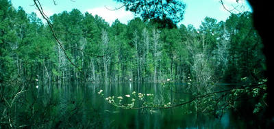
Anyway, today I am going to talk about the East Texas GIS and GPS Users Group (ETUG). ETUG is a small users group for East Texas and Western Louisiana. We get together quarterly, have lunch and discuss projects that we are working on. I will be president after the New Year and I hope to breathe new life into the organization. Historically, it has been based on more of a social level and I want to bring some technical and professional aspects to the group. We will see how well it is received. I'll keep you posted. While searching for a good map of East Texas I came across this wonderful picture of the old Aldridge Sawmill Site mill pond. I have been to this location and it is a good example of how beautiful East Texas is. You can find out more information at Texas Beyond History. It gives a little history of the East Texas timber industry as well. For more information on ETUG please visit our Yahoo! Groups page at ETUG-L. Here you can sign up to be email listserv to keep updated on events.

Planet Geospatial

ESRI.com - News

GISUser.com - The complete GIS, LBS, and Geospatial Technology Resource

A VerySpatial Podcast