 Good evening! It's been a busy one. We had our first regional emergency GIS team meeting at the City. We formed it to help in times of crisis. With the hurricane season coming soon we thought we might want to get a jump on it (we actually had to activate our EOC for both Katrina and Rita evacuees). This team is made up of several City departments and the County. We discussed issues like data availability, hardware, software, events, etc. Hopefully it will help if anything does happen. I included information today on HAZUS to go along with the theme.
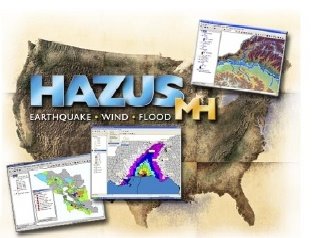
"HAZUS-MH is a powerful risk assessment software program for analyzing potential losses from floods, hurricane winds and earthquakes. In HAZUS-MH, current scientific and engineering knowledge is coupled with the latest geographic information systems (GIS) technology to produce estimates of hazard related damage before, or after, a disaster occurs. HAZUS-MH takes into account various impacts of a hazard event such as: Physical damage: damage to residential and commercial buildings, schools, critical facilities, and infrastructure; Economic loss: lost jobs, business interruptions, repair and reconstruction costs; and Social impacts: impacts to people, including requirements for shelters and medical aid. Federal, State and local government agencies and the private sector can now order HAZUS-MH free-of-charge from the FEMA Distribution Center." Check it out at http://www.fema.gov/plan/prevent/hazus/index.shtm.


No comments:
Post a Comment