Friday, June 30, 2006

Gmaps 101 - An Introduction to Google Maps & The Google Maps API (Part 3)

What a day! I finished my Intro to ArcGIS class. It always amazes me that I get so tired from teaching. All the questions and talking. I don't know how teachers do that everyday. Anyway, the weekend is here! I don't have any real plans other than cleaning the apartment since my girlfriend will be back in town next Friday! Have a great weekend!

Today, I'm passing on the third and final installment of Gmaps 101 - An Introduction to Google Maps & The Google Maps API from the GISUser. The third part takes you into AJAX (Asynchronous JavaScript + XML) and how it is revolutionizing the user experience of web mapping applications. In addition, they also cover various ways to geocode your data for Google Mapping applications. Check it out at http://www.gisuser.com/content/view/9207/28/. 6 Days!!!

Thursday, June 29, 2006

Wayfinder Earth

Howdy! I'm rushing around this morning trying to prepare for my class. It's always interesting how each class has a different feel to it. We will see what I get today. Gotta run!

"Wayfinder Earth puts the whole World at your fingertips. Get a view of the entire planet as a 3D globe on your mobile phone. Then simply choose a location and zoom in to city street level. Check out the best bars, restaurants, museums or hotels and get there without a hitch." Although the app is not available on all phones yet, including mine. It sounds cool, but they need some screen shots on their webpage. Check it out at http://www.wayfinderearth.com/index.us.php. 7 Days!!

Wednesday, June 28, 2006

geo visitors

What a day!! We had Gary in from Western Data Systems to give a little training on our new Trimble GeoXH. It's a pretty cool machine and it has 1' accuracy. Rock! Anyway, I've been going at it since 7:15. My meeting with the City Manager yesterday went well. He asked two questions and told us that we were doing a great job. So, the budget is looking good! Tomorrow I teach another Intro to ArcGIS I class. I've got a pretty full class so it should be interesting. It also includes many managers and directors. Well, I've got to go review my material. Notice my countdown to the ESRI UC on the right. Out!

Check out this tool from Digital Point Solutions. "It will automatically detect where in the world visitors are coming from when they visit your site. To use, copy/paste the HTML code on the right to your website." That's it! You can put it on your MySpace page or your blog. Check it out at http://www.digitalpoint.com/tools/geovisitors/. 8 Days!

Tuesday, June 27, 2006

ASCII Maps

Hola! I've got my big budget meeting today where the City Manager asks me questions concerning my requests for the upcoming year. Last year he took it easy on me so hopefully this year will be the same. Keep your fingers crossed. This morning I'm running over to the Library to install data for my Intro to ArcGIS course this Thursday and Friday. This afternoon after the budget meeting I've got to install some GPS software for training tomorrow. What fun! Have a good one!

The creators of ASCII Maps couldn't have said it better. "Google Maps in ASCII characters. Pure silliness for your enjoymentby the good people at Poly9 and the invaluable Markus Gebhard" Pure silliness is right, but I think it's a pretty interesting idea. The text actually keeps the shape of the features on the map. Zoom in to see what your hometown looks like in ASCII text. Check it out at http://www.asciimaps.com/. 9 Days!!!

Monday, June 26, 2006

The Genographic Project

Welcome to another week! I had a pretty great weekend. Hangin with the guys on Friday was quite fun! On Saturday night I went to a party. Afterward we made a midnight trip to Shreveport for a little casino action. Good thing we did because I hit $380 on a slot machine! All in all a pretty good weekend. FYI the agenda/planner for the ESRI User Conference is on their website. Also, they have a new blog for the UC at http://blogs.esri.com/roller/page/ucblog.

"The National Geographic Society, IBM, geneticist Spencer Wells, and the Waitt Family Foundation have launched the Genographic Project, a five-year effort to understand the human journey—where we came from and how we got to where we live today. This unprecedented effort will map humanity's genetic journey through the ages. The fossil record fixes human origins in Africa, but little is known about the great journey that took Homo sapiens to the far reaches of the Earth. How did we, each of us, end up where we are? Why do we appear in such a wide array of different colors and features? Such questions are even more amazing in light of genetic evidence that we are all related—descended from a common African ancestor who lived only 60,000 years ago." What's cool is that you can actually help using your own DNA. To learn more and find out how you can participate check out https://www3.nationalgeographic.com/genographic/index.html. 10 Days!!!

Friday, June 23, 2006

GIS Job Finder

Happy Friday! I've got four meetings today!! First up is my general staff meeting with the IT department. Then it's the Emergency GIS Team where we will discuss our results from our site address field verification pilot project. Then we have our monthly GIS User Committee meeting which always proves to be interesting. That's all before lunch!! After lunch I'm meeting the EOC corrdinator at the EOC to discuss the setup of the Emergency GIS Team among other things. Have a great weekend!! Me and the guys are going out for some trouble tonight and then I have a party to attend Saturday. It should be a fun one!

"Whether you are looking for a job or an employee, GIS Job Finder will locate what you have in mind. The fastest and best way to change your career or help to change someone else's future." If you are in pursuit of a change, check it out at http://www.gis-job-finder.com/. 14 Days!!

Thursday, June 22, 2006

Global MapAid

Good day! Well, I am officially starting to feel older. Today is my birthday and I am 29. Too many that doesn't sound old, but next year I will be 30 and that doesn't sound too good to me. Oh well, it's just another day right? My meetings yesterday went well! I've got another one for the entire second half of the day. We are developing strategies to help imrove our City in many areas including: Remaining responsive, open and flexible to our citizens; Promoting respect and dignity in all interactions; Sustaining and developing a competent workforce; Maintaining a safe and welcoming community; Exercising corporate responsibility for City resources and results; Seeking collaborative relationships. It should be interesting what we come up with.

"Global MapAid, a 501(c)3 not-for-profit organization, was formed with the aim of supplying specialist maps to humanitarian decision makers at all levels, predominantly in slow onset disasters such as famine, but also when necessary in rapid onset disasters such as a flood. GMA is intent upon supporting aid efforts by assisting in the provision of mapping and corresponding communication systems for humanitarian organizations. Maps are detailed of nature and will include population, food security, AIDS, refugee and famine data." Feel free to donate! Check it out at http://www.globalmapaid.rdvp.org/index.htm. 15 Days!!!!

Wednesday, June 21, 2006

OpenLayers

It's hump day! I've got a busy one. Our consultant will be in this morning. First we are going to discuss the requirements our ArcIMS site. I'm curious to see how this goes because we are asking for alot. This afternoon we are going to meet with our Public Works department and a consultant of theirs to discuss some overlap in work between the two consultants. That could turn out to be very interesting. On a different note, I had Peter Konnecke contact me from Australia. Peter runs the Konnecke blog where he gives news, views, rants, raves, opinions and images from an Australian perspective usually focusing on Technology. Check it out at http://www.konnecke.com/. Oh yeah, check out my 43 places map and list on the right. I'm hooked!

"OpenLayers makes it easy to put a dynamic map in any web page. It can display map tiles and markers loaded from any source. MetaCarta developed the initial version of OpenLayers and gave it to the public to further the use of geographic information of all kinds. OpenLayers is completely free, Open Source JavaScript, released under the BSD License. OpenLayers is a pure JavaScript library for displaying map data in most modern web browsers, with no server-side dependencies. OpenLayers implements a (still-developing) JavaScript API for building rich web-based geographic applications, similar to the Google Maps and MSN Virtual Earth APIs, with one important difference -- OpenLayers is Free Software, developed for and by the Open Source software community." Check it out at http://www.openlayers.org/. 16 Days!!

Tuesday, June 20, 2006

43 Places

Hola! Well my busy week starts today. I've got the Supervisor's Network at lunch today where we will be discussing budgeting. I mention it every month, but this is a group setup by the City of existing supervisors and potential supervisors to help them learn about some of the duties of being a supervisor. After that I'm off to the EOC to setup the area that the Emergency GIS Team will be stationed. The Emergency GIS Team was formed to improve the use of GIS and supporting information services in the EOC as well as work on projects to make the City better prepared for emergency events. Its’ official mission is to integrate all information necessary to develop a common operational picture for senior leadership and other emergency responders. More specifically the Team will collect, analyze, and disseminate information across all Emergency Support Functions. The focus of the team will be to develop an integrated common operational picture of an emergency event. It will review information coming from the field, departmental control centers and EOC personnel to quality control the data, identify gaps and develop intelligence products for City staff. One last note, Antonio Fraga Fernandez, sent me a note the other day telling me about his Spanish version of the GeoBlog! The blog is in Spanish (I'm sure you could translate it), but I'm going to start reading to improve my limited Spanish skills. Check it out at http://antoniofraga.blogspot.com/.

43 Places lets you “Share stories about places in your city and around the world. Travel changes people. Whether it is finding a great new coffee shop in your city or a life altering trip around the world, finding great places can make us happier people. 43 Places helps you make a list of the great places you want to visit and share stories and photos of the places you’ve been." So why is it called 43 Places? "Everything needs a name. We think 43 is the right number of places for a busy person to try and visit. Why not more? It’s too much. Why not less? You can do less, but it is still called 43 Places. Also, we had this site called 43 Things and we thought the name was fitting." You can even view the places people have posted on a Google Map. Check it out at http://www.43places.com/. 17 Days!!!

Monday, June 19, 2006

gps tracklog

Happy Monday! I had a good weekend, but I am a bit tired from the driving. I had some excellent Indian food yesterday afternoon and the Rangers won their game. On Saturday, I got hooked on MySpace. If you haven't gotten into this yet, DON'T. You will never sleep! If you are interested in my MySpace page you can find a link to the right. This week is looking pretty busy, but I don't have any meetings today.

GPS tracklog is a blog about anything and everything GPS. The author states, "I'm an outdoor recreation enthusiast and I love getting "way back" where humans rarely tread. Having a life-long love of maps, when I finally purchased my first GPS, I got into it fairly heavily. My quest to create the most complete map of my favorite natural areas resulted in me trying many different mapping programs. I also love to share and write, so when I realized there was no book on this subject, I set out to write one. The result was 'GPS Mapping - Make Your Own Maps'. When I'm not outside exploring or inside blogging, I have a day job too, as Executive Director of Mendocino Coast Botanical Gardens." You can find information here about Accessories, Garmin, Geocaching, GIS, GPS News, GPS Reviews, GPS Tracking, Hardware, Internet applications, Location based services, Lowrance, Magellan, Maps, Software, Software Reviews, The business of GPS and Waypoints. Check it out at http://gpstracklog.typepad.com/gps_tracklog/. 18 days till my girlfriend comes home!

Friday, June 16, 2006

ESRI Blogs

It's Friday and I don't have any meetings!! I'm running over to Dallas this weekend to check on my rental house. My tenants moved out and I want to see what the condition of the place is. I'm also going to take in my first Texas Rangers game of the season. It figures that the first season that they are doing well I don't go to any games. If they start losing after this weekend don't blame me. Have a great weekend!

ESRI has entered the World of blogs! They only have one out so far, called Geography Matters. It has hit on topics such as A Degree in Geography Just May be the Next "Engineering", My Wonderful World, and Geography Matters to Everyone. Hopefully they will add more blogs in the near future. Check it out at http://blogs.esri.com/roller/blogs.do.

Thursday, June 15, 2006

The Geography of Seinfeld

Good morning! This afternoon I will be working on my portion of the pilot phase of site address field verification. We desparately need an accurate point site address layer in our City. Currently when we geocode to our parcel layer we have about a 60% - 70% match. I'm hoping that this layer will help with that as well as create a master address file for us. Cross your fingers for us. On an unrelated note the GISUser had an interesting article about how the New Orleans is using GPS to catch wild dogs and cats. It seems they have an growing population since the hurricane. Read it at http://www.gisuser.com/content/view/9057/.

Check this one out! "Join the gang in this Seinfeld Google Maps Mashup. Address and locations are from the actual Seinfeld scripts, observations, your input, and website descriptions. Since some address are from the scripts, they may not make perfect sense in a real life. Join Elaine, Kramer, and George to build your own Jerry Seinfeld virtual tour!" Check it out at http://www.stolasgeospatial.com/seinfeld.htm.

Wednesday, June 14, 2006

TopoFusion

Good morning! I think I am ready for my Executive Committee meeting today. I only worked on it until nine last night! I also hope to finish reviewing our addressing standards today. This is a project we have been working on for too long! If you have ever done this you will understand why. Have a great day!

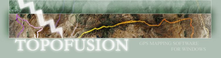
"TopoFusion is GPS Mapping software for Windows. It downloads maps (Topo, Aerial Photo and Satellite) automatically from Microsoft's TerraServer and NASA's OnEarth server, storing them on the hard drive for offline use. Please download and use the free version. It is fully functional except that 1/3rd of the map tiles are obscured with the word DEMO. It is not time limited, so you are free to keep and use it. The aim is to continually nudge the state of the art in mapping software forward. A few examples include: Efficient, versatile map display engine. TopoFusion runs the way a modern mapping application should--fast and smooth.; Combo Topo/Aerial Maps: Topo and photo maps are combined using alpha blending to visualize both at the same time.; Image Processing: Adjust brightness, contrast, sharpness and blurring on aerial, topo and combo maps.; PhotoFusion: Geo-reference digital photos using EXIF timestamps. Places photos along GPS tracks and produces HTML pages with clickable image maps.; Multi-track playback: Visualize multiple trips recorded by GPS simultaneously.; Networks: Create and manage networks of GPS data. Combine multiple GPS tracklogs into a network, with duplicate portions of track logs averaged.; Splining/Simplifying GPS data: Increase or decrease the number of points in a track log. Check it out at http://topofusion.com/.

Tuesday, June 13, 2006

IBISEYE

Howdy! Another day in paradise. I've been working on getting my budget finally finished. Paperwork sucks!! I also have an Executive Committee meeting tomorrow so I have to prepare for that too. I've mentioned it before, but the Executive Committee is an invaluable group that we have here at the City. Not only does it allow City departments to give feedback at the manager level. It also allows me to get buy-in on projects that I want to implement. On a personal note I'm going to pick up my Expedition from the shop at lunch. I swear I have replaced all eight of the coils on this piece. If anyone out there owns a Ford and they have had the same problem let me know. I think it is time for a class action law suit. Ha!

Here is a cool one for all you weather bugs! I'm especially interested since my girlfriend is living in the path of most hurricanes. IBISEYE is a hurricane tracking mashup using Google. It is created by "the Herald Tribune Media Group which is based in Sarasota, Fl. and is owned by the New York Times Co. The Weather Underground is feeding all the weather alerts and tropical storm updates. The historic tropical storm data came from the National Weather Service. The underlying maps are served by Google Maps. The property records data came from the Florida Department of Revenue and numerous county property appraisers and GIS departments across the state." It is pretty cool because it has a risk estimator and you can view past paths. Check it out at http://www.ibiseye.com/.

Monday, June 12, 2006

Geo WhitePages

Happy Monday! Another week has began. I've spent most of my morning getting a handle on the numerous projects we have in the works. This afternoon I'm meeting with our Parks department to get an update on our Tree Inventory and update some GPS files for them. My girlfriend told me last night that she is shooting for the end of the month to return home. Keep your fingers crossed for me!

"GeoWhitePages.com provides a free people search service that displays its search results on a map. Instantly find friends and family by performing a Name or Phone search. You can also click on the green census cylinders to give you the 2000 U.S. Census data of the areas your friends or family live." This mashup is too cool! It's great to search for old friends and even see where they are living. Now we can all be Big Brother! Check it out at http://www.geowhitepages.com/.

Friday, June 09, 2006

Drinktown

Happy Friday! What a week! It's bad enough to come back from vacation to hundreds of emails and requests, but to come back to multiple events and a crisis. Arrr! BTW the girlfriend is much better now. I've procrastinated entering my budget long enough. Today it must be completed. Hopefully it doesn't take too long or else it will be a late night on a FRIDAY. Oh well, have a great weekend. I thought today's post was appropriate for my mood.

Unfortunately, this awesome mashup is only available in Chicago, Washington D.C., Baltimore and Milwaukee. "With hundreds of bars and thousands of specials Drinktown helps you start the night right by mapping the night out. Got a taste for Half-Price Wine? Use our maps and filters to find the nearest wine special and you've got it." It also has this cool tool that lets you create your own pub crawl. You just click a path and shows the bars that match your filter. Too cool! Check it out at http://www.drinktown.com/.

Thursday, June 08, 2006

Wikimapia

Morning! Sorry I didn't post yesterday, but I had a bit of crisis. My girlfriend had to go to the hospital in MEXICO! That statement is just scary. Anyway, she is out and fine. It appears she had a severe kidney infection. Anyway, I'm off to an East Texas GIS & GPS User Group meeting. It should be a good one. The speakers are going to discuss hurricane preparedness and we will have the World's most accurate four foot globe on display. Too cool!

"WikiMapia is a project to describe the whole planet Earth. Just move the map to find interesting places and click on the rectangles. To add an interesting place or object use Add New link. The only rule is to only add places interesting to everyone. Check it out at http://www.wikimapia.org/.

Tuesday, June 06, 2006

MotionBased

I'm back!!! Wow.....what a week.....but I am tired! I got in about eleven last night from driving back from Houston. The stay in Galveston was OK. Too many partying Memorial Day vacationers and I wasn't in the mood to party. My mind was on getting to Mexico. Although, I did catch a nice flounder while fishing and ate a ton of shrimp. I made it to the rancho in Mexico about five hours later than I was suposed to on Monday. Rain storms in Houston made everything delayed, but I finally got to see my girlfriend. She is getting so skinny from walking through the jungles everyday. I kept telling her that she needed a sandwhich! The next day we caught and banded one of her woodpeckers. That was quite an experience. That afternoon we were off to Chichen Itza. We missed the light show that they do on El Castillo every night due to another rain storm, but we didn't mind because we sat in the open air bar, drank beers and enjoyed the cool weather the rain brought. On Wednesday we explored Chichen Itza which is massive. What a fasinating culture (the Mayans)! That afternoon we ventured on to Merida, which is the capital of the Yucatan State, where we stayed in a hotel that was built in 1901. We shopped, ate, drank and enjoyed this great city. After shopping some more we headed back to the rancho where we entertained the Mayan workers with cold beers and chocolate. Friday we headed to Isla Mujeres. This is a beautiful island northeast of Cancun that is a tourist spot, but not to the extent of Cancun (many Mexican families vacation here). The beaches were white and the water was crystal clear. We spent two days eating fresh seafood, drinking and being lazy on the beach. It was great! When we returned on Sunday my girlfriend got to watch the episodes of Survivor that she missed while in Mexico. That afternoon I returned to Houston where I boarded another plane to New Orleans. It was interesting to see the condition of the City since I have been there several times before. It is by no means back to where it used to be, but they are making good progress. The Quarter of course is functioning and the Royal Sonesta hotel where the 2007 SCAUG conference will be held is incredible. We toured and discussed the hotel on Monday and I flew back to Houston last night. I'm beat!! No more major trips are scheduled until the ESRI conference in August. I'm glad!

"Using data collected from GPS devices, MotionBased empowers its customers with online data and mapping analysis, unattainable with the current set of products available to endurance athletes. While GPS technology has been available for many years to outdoor enthusiasts, few applications exist on the market where GPS data is effectively harnessed and analyzed for fitness and training. Performance analysis, online mapping, and route sharing provided by MotionBased will not only make GPS devices more valuable but will change the way athletes train." Check it out at http://www.motionbased.com/.

Planet Geospatial

ESRI.com - News

GISUser.com - The complete GIS, LBS, and Geospatial Technology Resource

A VerySpatial Podcast